Leadburn Community Woodland – March 2026
The woodland is slowly emerging from winter dormancy. This month, however, it is interesting to have some reminders of its previous life:-
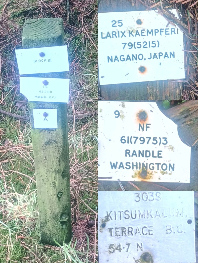
In the late 20thC, under the Forestry Commission, Restoration Bog was an area of experimental forestry plots. Some of the old labels can still be seen.
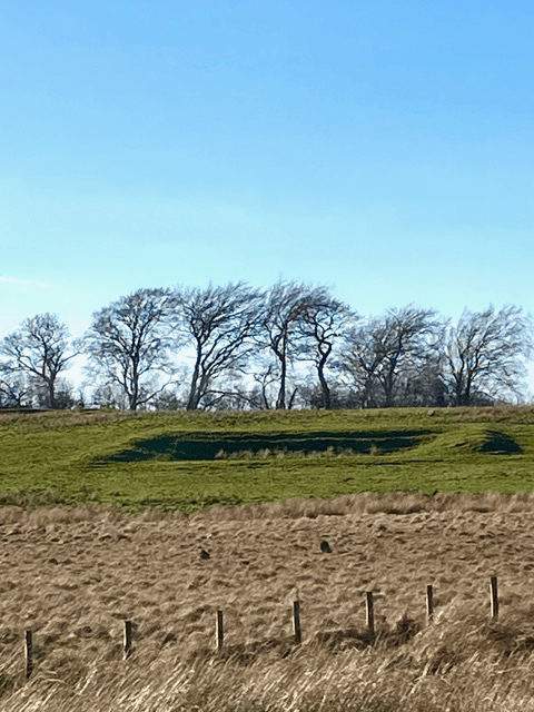
Before that, in the 1940s, WW2 ammunition huts covered much of the rest of the Woodland. This photo (taken from just beyond our boundary) shows clearly the protective earth ramparts that surrounded each hut .
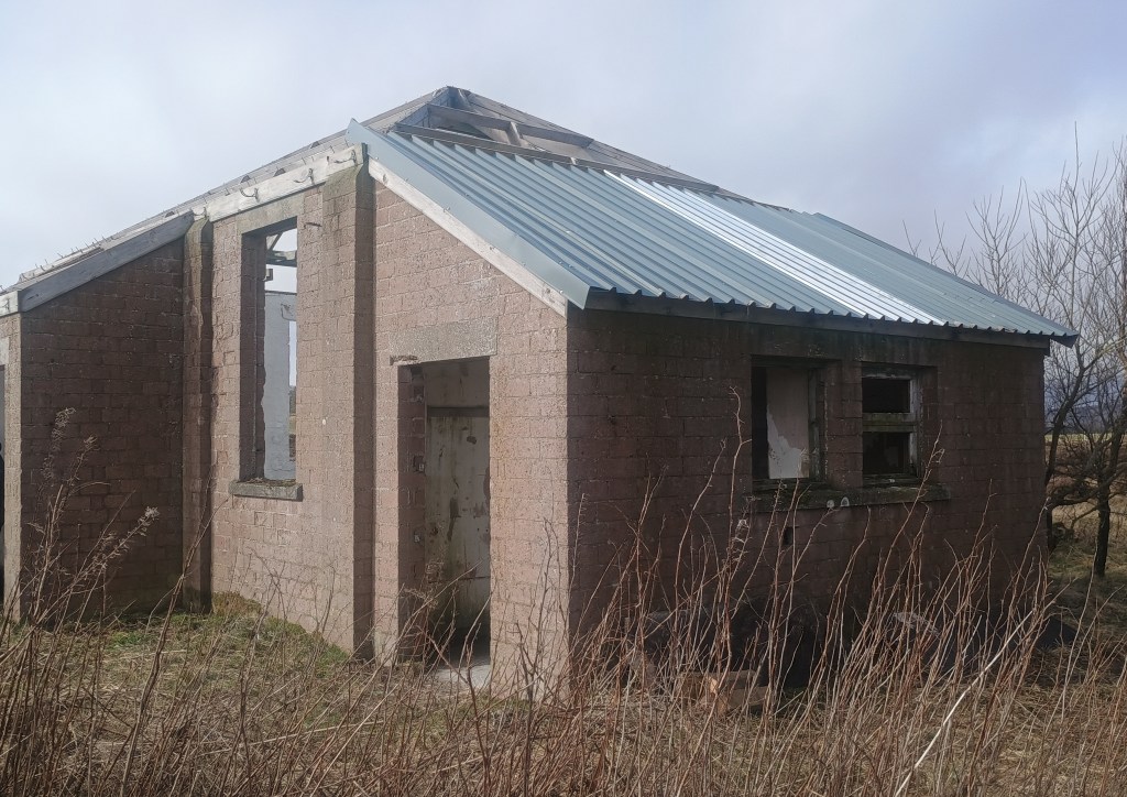
The final photo shows the results of last month’s volunteer work on renewing the end section of the WW2 building roof.
Website: https://leadburnwood.com/
For any further contact or queries, or if you no longer wish to be included in these emails, please contact us at: leadburncw@hotmail.com

Leave a reply to pstevenson12345 Cancel reply